
Archivo:North america terrain 2003.jpg

Archivo original (3790 × 2922 píxeles; tamaño de archivo: 1,9 MB; tipo MIME: image/jpeg)
| Este archivo es de Wikimedia Commons y puede usarse en otros proyectos. La descripción en su página de descripción del archivo se muestra debajo. |
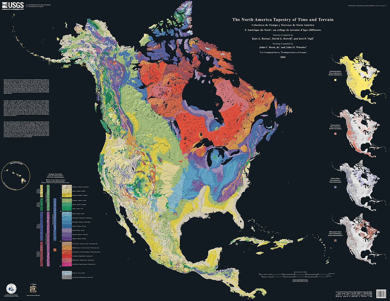
The North America Tapestry of Time and Terrain (1:8,000,000 scale) is a product of the United States Geological Survey in the I-map series (I-2781). This map was prepared in collaboration with the Geological Survey of Canada and the Mexican Consejo Recursos de Minerales.
This cartographic tapestry is woven from a geologic map and a shaded relief image. This digital combination reveals the geologic history of North America through the interrelation of rock type, topography and time. Regional surface processes as well as continent-scale tectonic events are exposed in the three dimensions of space and the fourth dimension, geologic time. The large map shows the varying age of bedrock underlying North America, while four smaller maps show the distribution of four principal types of rock: sedimentary, volcanic, plutonic and metamorphic.
Related images
Four maps show the North American distribution of four principal types of rock: sedimentary, volcanic, plutonic and metamorphic.


There are separate images of the main map, time scale, and rock type maps.
-
 North American terrain
 -
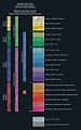 Time scale
 -
 North American rock types


Source
Esta imagen está en el dominio público, ya que contiene materiales que originalmente vinieron del Servicio Geológico de los Estados Unidos de América, una agencia del Departamento del Interior. Para obtener más información, consulte la política oficial de derechos de los USGS.
|
Home: http://pubs.usgs.gov/imap/i2781/
Image: http://pubs.usgs.gov/imap/i2781/i2781_c_low.pdf 144 dpi, encoded to 72 dpi JPEG, compressed slightly to fit within Wikipedia 2MB limit.
Source: English Wikipedia, original upload 15 April 2005 by SEWilco
Historial del archivo
Haz clic sobre una fecha y hora para ver el archivo tal como apareció en ese momento.
| Fecha y hora | Miniatura | Dimensiones | Usuario | Comentario | |
|---|---|---|---|---|---|
| actual | 16:04 16 sep 2005 | | 3790 × 2922 (1,9 MB) | Saperaud~commonswiki | The North America Tapestry of Time and Terrain (1:8,000,000 scale) is a product of the United States Geological Survey in the I-map series (I-2781). This map was prepared in collaboration with the Geological Survey of Canada and the [[Mexican |
Usos del archivo
No hay páginas que enlacen a este archivo.
Uso global del archivo
Las wikis siguientes utilizan este archivo:
- Uso en de.wikipedia.org
- Uso en en.wikipedia.org
- Uso en en.wikiversity.org
- Uso en fa.wikipedia.org
- Uso en ja.wikipedia.org
- Uso en www.wikidata.org